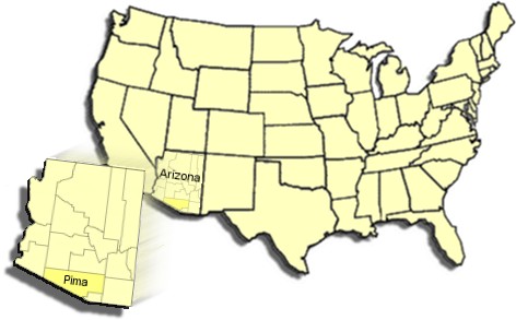
County History
The land that was and is now Pima County was part of the Gadsden Purchase. On December 30, 1853, the United States purchased
from Mexico a strip of land lying south of the Gila River. The consideration was $10 million in gold. The boundaries were established as follows:
ARTICLE I. The Mexican Republic agrees to designate the following as her true limits with the United States for the future...Beginning in the Gulf of Mexico, three leagues from land, opposite the mouth of the Rio Grande, as provided in the fifth article of the treaty of Guadalupe Hidalgo; thence, as defined in the said article, up the middle of that river to the point where the parallel of 31°47' north latitude crosses the same; thence due west one hundred miles; thence south to the parallel of 31°20' north latitude; thence along the said parallel of 31°20' to the 111th meridian of longitude west of Greenwich; thence in a straight line to a point on the Colorado River twenty English miles below the junction of the Gila and Colorado Rivers; thence up the middle of the said river Colorado until it intersects the present line between the United States and Mexico.
When it was part of the New Mexico Territory, the land that in 1864 became Pima County, Arizona Territory was part of Doña Ana and, later, Ewell and Mesilla counties. As it was then established, Pima County covered almost 30,000 square miles; it has been whittled down over the years to a mere 9,240 square miles. Pima County by itself is larger than each of the six smallest states. Additionally, Pima County is larger than the three smallest states combined.
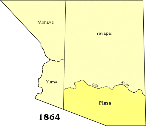
1864 ~ The Arizona Territory is established and four counties are created: Pima, Yuma, Yavapai and Mohave.
1865 ~ Pah-Ute County is organized from Northern Mohave.
1866 ~ North-western Arizona is ceded to Nevada.
1871 ~ Pah-Ute County is dissolved; Maricopa is created.
1875 ~ Pinal County is created; Maricopa is enlarged.
1877 ~ An error in the Pima County boundary is corrected; Maricopa is again enlarged.
1879 ~ Apache County is established.
1881 ~ Cochise, Graham, and Gila Counties are organized.
1889 ~ Gila County is enlarged northward, Mohave eastward.
1891 ~ Coconino County is created from Northern Yavapai.
1895 ~ Western Apache County becomes Navajo County.
1899 ~ Santa Cruz County is established from South-eastern Pima.
1909 ~ Greenlee County is established from Eastern Graham County.
1983 ~ Yuma, the last untouched county disappears as La Paz County is created.